

This article was originally published on VOA News - America. You can read the original article HERE
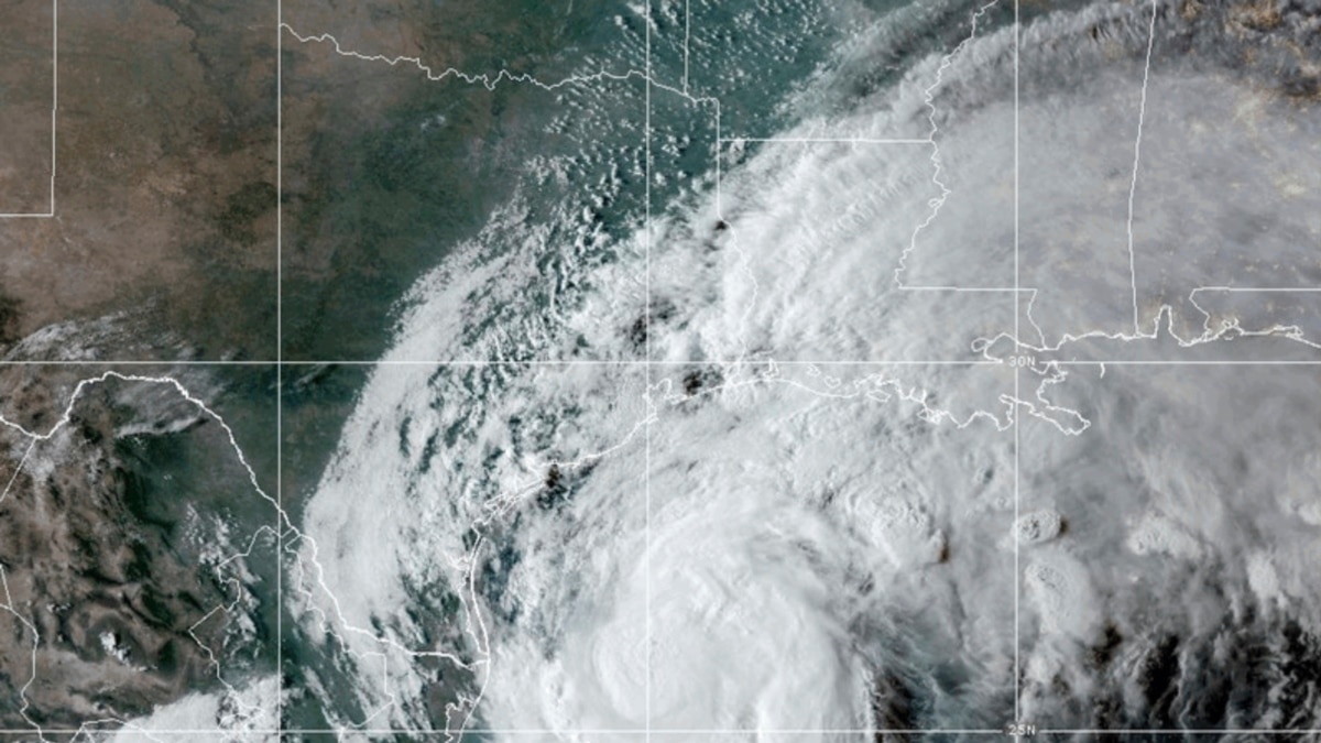
Francine strengthened into a hurricane late Tuesday as it steadily moves toward Louisiana's coast.
A hurricane warning is in effect from the Texas border to Grand Isle, about 80 kilometers south of New Orleans, according to the National Hurricane Center (NHC).
Hurricane Francine is about 563 kilometers southwest of Morgan City, Louisiana.
Mandatory and voluntary evacuation orders have been issued for several of Louisiana's parishes. Storm surge warnings are also posted in Texas and Louisiana.
The National Guard, equipped with food, water, high-water vehicles, boats and helicopters, is being deployed to Louisiana areas that will likely be hardest hit by Francine's wind and rain.
Louisiana Governor Jeff Landry has urged the state's residents to "batten down all the hatches," before Francine lands and spreads havoc.
"The impact of torrential rainfall, coastal flash flooding, damaging winds, and hurricane-spawn tornadoes will pose a serious threat to the lives and property of the people of Louisiana," Landry wrote in a letter to U.S. President Joe Biden, requesting that the president declare a state of emergency for Louisiana.
Landry said in the email that "river flooding, strong winds, and tornadoes are anticipated ... across much of the state."
New Orleans resident Roxanne Riley, 42, told The Associated Press that she is staying with a family member who lives on high ground in anticipation of Francine's arrival but would evacuate if Francine forced her to.
"I'll just make sure my car is ready to roll in case I need to go by tomorrow," Riley said. "I'm going to keep on checking to see what it's looking like."
Francine's rains are also set to hit Mississippi, far southern Alabama and the western Florida Panhandle with 10 to 20 centimeters (4 to 8 inches) of rain and as much as 30 centimeters (12 inches) in some locations, leading to what NHC meteorologists said could be "considerable flash and urban flooding."
There will be deep water along the coast where Francine makes landfall, NHC said, "where the surge will be accompanied by large and dangerous waves."
Louisiana and Mississippi are giving away thousands of sandbags to residents. The bags are a traditional component of home protection and are designed to prevent water from seeping into houses and other buildings.
Residents in both states are also boarding up their windows as they prepare for Francine's landing.
Francine, the sixth named storm of the Atlantic hurricane season, is expected to be felt Wednesday morning as it nears the Louisiana coast with maximum sustained winds of 120 kilometers per hour or more, forecasters said.
Francine is expected to "weaken quickly" after it makes landfall Wednesday and moves into Mississippi, NHC said.
Some information in this report came from The Associated Press.
This article was originally published by VOA News - America. We only curate news from sources that align with the core values of our intended conservative audience. If you like the news you read here we encourage you to utilize the original sources for even more great news and opinions you can trust!


Comments